Fishing after a storm
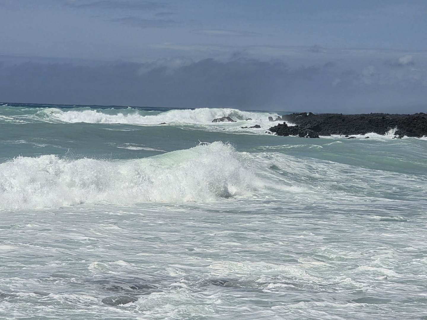
Hurricane Lowell tracked past the Hawaiian chain over the last three days. Surf built to 20–30 feet on the south shores of Kauai and Niihau, 15–25 on Oahu, 12–16 across Maui County and Hawaii Island. Ocean Safety put extra lifeguards on jet skis and told anyone without advanced experience to stay out of the water.
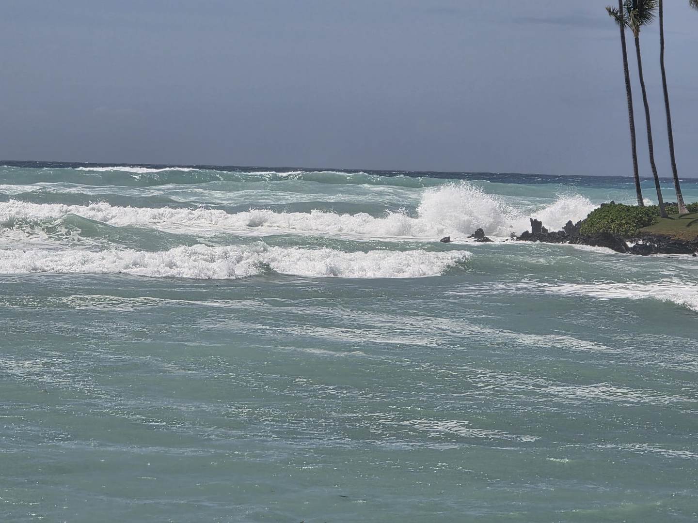
I spent today watching it from Waikoloa, on the South Kohala coast. Not fishing it — watching it, and taking notes for the next few days.
Most post-storm advice is about the wrong kind of storm
Search this subject and you get the same article twenty times: pressure crashes, rain floods the estuaries, runoff pushes bait out of the creeks, fish stack at the mouth. All of that describes a direct hit — a system that sat on top of you and emptied the sky.
Lowell wasn't that here. It was a swell event: a storm passing near enough to throw enormous energy at the coast without the rain. The two produce genuinely different water, and the difference decides where you'd stand.
| Rain-driven storm | Swell-driven storm | |
|---|---|---|
| Main change | Freshwater volume, salinity drop | Wave energy, mechanical disturbance |
| Where bait moves | Flushed out of estuaries and creeks | Stripped off the bottom and out of the wash |
| Water colour | Tannic and brown, from upstream | Sand-green, from below — clears faster |
| Where to fish | Creek and river mouths on the outflow | Structure edges, cuts, wherever energy is broken |
| Clears in | Days to weeks | Often 24–72 hours |
What I actually watched happen
Three things, all mechanical, all visible from shore.
The berm moved all day
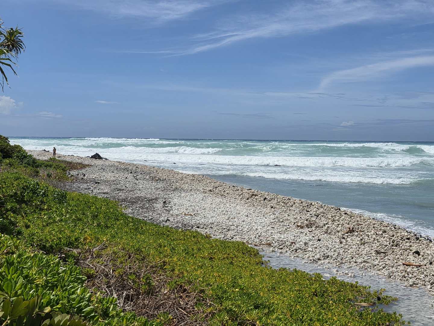
The coral rubble berm along this stretch didn't get rearranged once and settle. It moved continuously, shifting through the day as sets kept arriving. Material piled in one place at ten in the morning was somewhere else by two.
That matters more than it sounds. The structure you scout during a swell is not the structure you'll fish afterwards, and anything mapped today is provisional until the energy drops.
The water was churned 100 yards out
Not just the impact zone — a solid hundred yards of discoloured, aerated water off the shoreline. Green-milky rather than brown, which is exactly what you'd expect when sediment is coming up off the bottom rather than down from a river.
Sand was being pulled 200–300 yards offshore
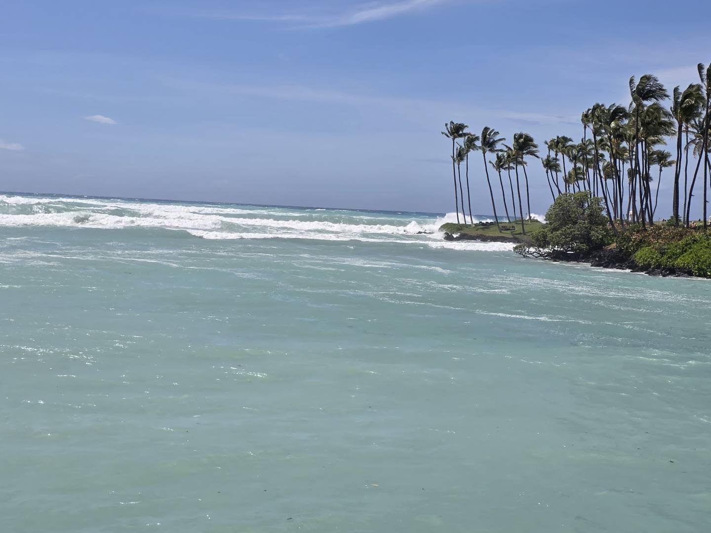
This is the one worth paying attention to. Material was visibly moving seaward well beyond the break, two to three hundred yards out. That's the beach profile being rebuilt: sand stripped off the face and deposited offshore, where it sits as bar until smaller swell walks it back in over the following weeks.
Which means the holes, cuts and bars along this coast are being redrawn right now, and the map I had a week ago is worthless.
Where the energy breaks is where you fish
The most useful frame I took all day is the least dramatic one.
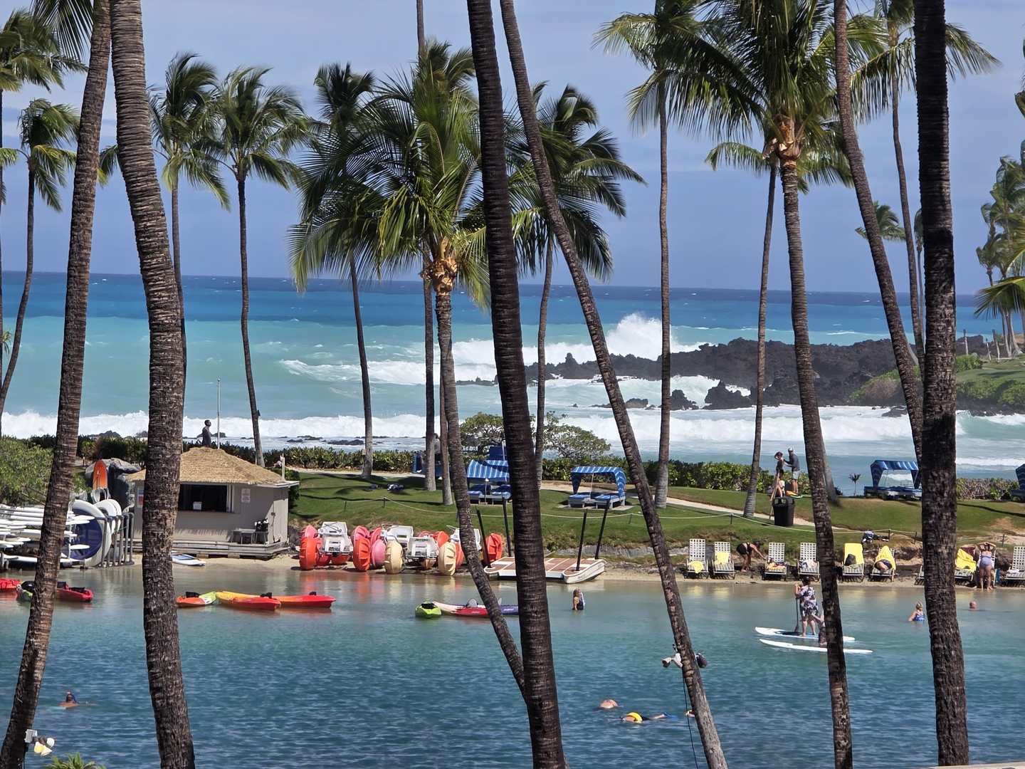
Reef takes the energy out; everything behind it stays fishable. That edge — where chaos becomes calm — is where displaced food ends up and where predators wait for it. On a coast like this, post-storm fishing is largely a matter of finding that line and working it.
What holds up, and what's just repeated
A few things about post-storm water are solid, because you can watch them:
- Bait gets displaced. Heavy surf tears organisms off the bottom and out of structure and puts them in the water column, disoriented.
- Structure moves. Documented above, over about four hours.
- Turbidity shifts the advantage. Sight-hunters lose their edge in stirred water and scent matters more — which is why bait leaving a blood or oil trail tends to beat lures in this stuff.
- Debris lines form along current seams, and those seams concentrate food.
What holds up less well is the barometric pressure story — that fish feed hard 24–48 hours before a front, shut down for a week, then resume on a schedule you can plan around. It's plausible that pressure matters to fish with swim bladders. It's a long way from plausible to the hour-by-hour feeding windows that get published.
Nearly everything written on this subject is charter operators and tackle blogs citing each other. The mechanical effects are observable. The pressure schedules are folklore wearing a lab coat.
The plan for the next few days
Wait, then read the beach again from scratch.
- Find the new cuts. A fresh channel through a rebuilt bar is the best thing a swell can hand you, and it may not survive the next one.
- Work the colour change. Where stirred water meets clean water is an edge, and it often fishes better than either side of it.
- Scent over finesse. Sight-feeding advantages are gone while it stays dirty.
- Heavier leader. There's material in the water and the bottom has been rearranged into things that cut.
- Move quickly. Swell-driven turbidity often clears inside three days. The window shuts from both ends.
The part that actually matters
Twenty to thirty feet of surf is not a fishing condition. It's a hazard.
Shore anglers die in post-storm water with grim regularity, and nearly always the same way — standing on rock that was dry ten minutes earlier, caught by a set outside the rhythm they'd been watching. Storm surf does not run on an interval you can time from the beach. Sets arrive bigger and further up than the pattern suggests.
Which is why today was a watching day. The fishing after a swell is genuinely good, but it's good for days rather than hours, and the water is survivable at the back end of that window rather than the front.
Observations are first-hand from South Kohala, Hawaii Island, on 8 September 2026. Surf figures are as reported by the National Weather Service for the wider chain. Check current NWS advisories and local Ocean Safety guidance before going near the water.